


Varanasi's Iconic Riverfront Sinking Due to Groundwater Depletion: Study
Scientists Highlight Urgent Need for Water Management Strategies
The distinctive geology that causes the Ganga to flow through the city and the constant depletion of groundwater are causing the land along Varanasi's famous riverbank to sink.
Researchers at the US universities of Banaras Hindu University and Chapman University have computed land subsidence rates along riverfronts that range from 2 to 8 millimeters per year by combining groundwater and rainfall observations with data from satellites.
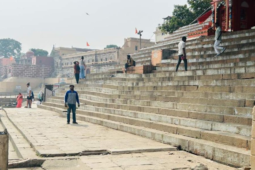
Between February 2017 and August 2023, the Manikarnika ghat (near the Kashi Vishwanath temple), the Harishchandra ghat, and the Ravidas ghat showed cumulative subsidence levels ranging from 2 cm to 2.5 cm, according to their study. There was 3 to 5 cm of subsidence at the Chousatti, Prahlag, and Samne ghats.
"Our results emphasize the necessity for methodical assessments of subsidence throughout the ghats," Ashwani Raju, the BHU assistant professor of geology who oversaw the investigation, stated to The Telegraph. The results of Raju's research have been published in the peer-reviewed journal Science of the Total Environment.
The experts have demanded that subsidence rates be considered in future plans for groundwater use and water management in Varanasi, a city that has steadily lost groundwater due to population increase, fast urbanization, and intensive farming on adjacent farmland.
Using information from the government and state groundwater boards as well as data from a US satellite from 2003 to 2023, Raju and his primary partner Ramesh Singh of Chapman University evaluated changes in groundwater levels. Additionally, they tracked ground displacements from 2017 to 2023 using information from a European satellite.
One of the oldest cities in the world to still be inhabited is Varanasi. Discoveries from archaeological digs have shown that its earliest settlements date to 1200 BC.
Also, since the sixth century AD, the city's riverfront has become a popular destination for pilgrims.
Over the past ten years, numerous studies have shown extensive groundwater depletion over huge areas of land, ranging from the Indo-Gangetic plains to the foothills of the Himalayas.
Sand, silt, and clay strata alternately rest atop one another in the Indo-Gangetic plains, with an average depth of 4.9 km above ancient bedrock.
Because groundwater is trapped in sand layers, its depletion hinders groundwater replenishment by causing irreversible deformation of the clay layers. Land subsidence is the end result of these processes.
Land subsidence has been connected to groundwater depletion at numerous locations across the globe, including Indo-Gangetic plain towns like Chandigarh, Delhi, and Lucknow. With rates of up to 30 cm annually, Mexico City and Tehran have the highest rates of sinking.
However, the way the Ganga water travels along the geological fault that runs through Varanasi exacerbates the effect of groundwater depletion along the riverbank and ghats.
The erosion of the ghat parts along the riverbank is caused by high water velocity along the meandering ghats, according to Raju. The city of Varanasi is experiencing a shortage of groundwater. However, the river's impacts amplify sinking along the ghats. The alterations or undulations on the stairways of some of the ghats are indicative of these effects.
Mitali Sinha, Saurabh Singh, Abhinav Patel, and Praveen Kanojia from the BHU were the other collaborators.
Except for the headline, this story has not been edited by Press Time staff and has been published from a syndicated feed.


